Phantom Ranch is located at the bottom of the Canyon on the Colorado River and at the intersection of the Bright Angel and Kaibab Trails. The Ranch is basically hidden from view to tourists on the rims. To reach the Ranch, one normally hikes or rides the mules down the one mile elevation change from either rim. Along the way down, the trail goes through a variety of climate zones: from cool air and pine forests on the rims to heat and sparse desert vegetation at river level.
An expensive alternative to hiking or riding mules is air-rescue helicopter rides for those who become dehydrated and sick on the trails. During my first serious hike in the Canyon, I witnessed a helicopter rescue near Indian Garden of some unfortunate Swiss hikers attempting to hike from the South Rim to the river and back in one day. Needless-to-say, this idea is strongly discouraged by the Park Service.
My trip to Phantom Ranch started near Yaki Point on the South Rim, by hiking the South Kaibab Trail on a hot windy day in early May. Two thirds of the way down, sore toes slowed my progress. The constant incline down was wearing on leg and foot joints, while on each step, my toes jammed to the front of my hiking boots. Rests became frequent, where every bend on the trail was an excuse to give my toes a break and take a photograph. I finally reached the Tonto Plateau some 3500′ below the South Rim, where the trail was relatively flat and my toes no longer complaining on each step. This is the lowest level in the Canyon before entering the Inner Gorge.
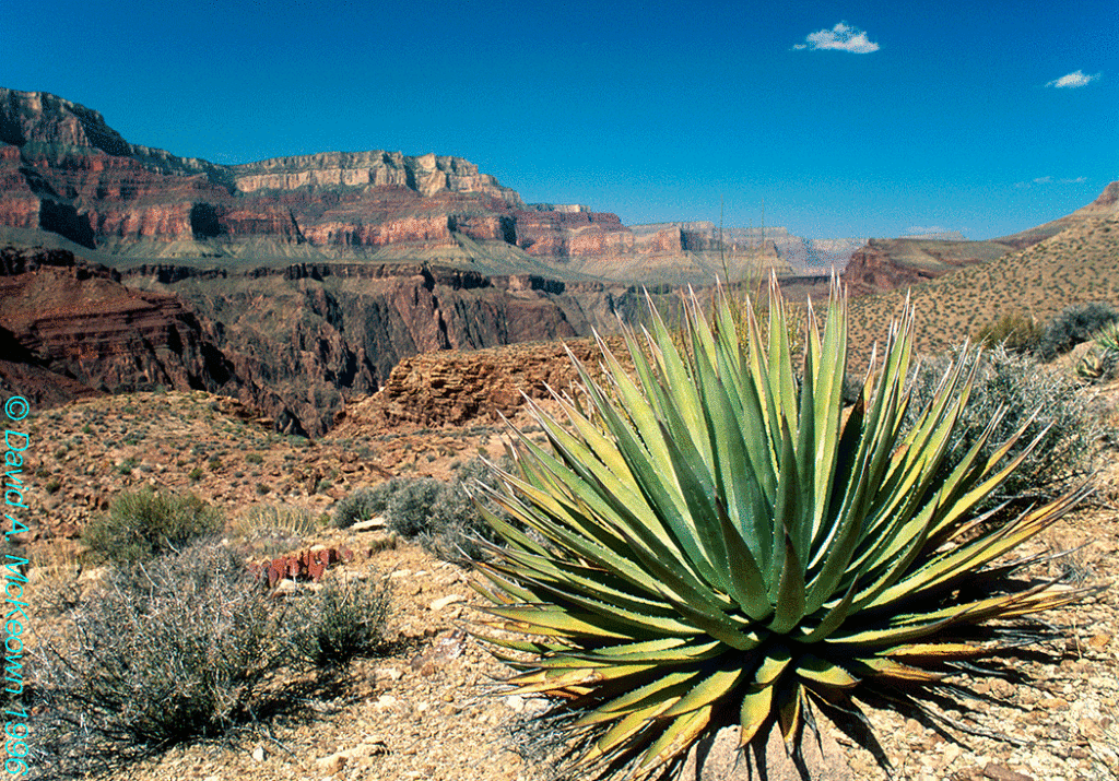
May is a special time on the Tonto Plateau and at lower elevations, because some of the agaves are in bloom. An agave spends a last burst of energy at the end of its life by sending up a flower stalk. The stalk can be well over 15′ tall and display a spectacular column of yellow flowers that is buzzing with insects and hummingbirds. This came as a complete surprise to me when first seeing these brilliant yellow displays. No one along the rims peering into the Canyon, would guess this would be on view in areas that appear so barren from above.
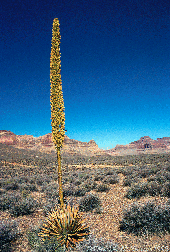
Grand Canyon Agave 25-96: All things great and small, on the trail to Plateau Point. This was unintentionally my first hummingbird photograph. I had no idea the bird was there (above the cliffs, lower right of the flower column) until reviewing slides at home.
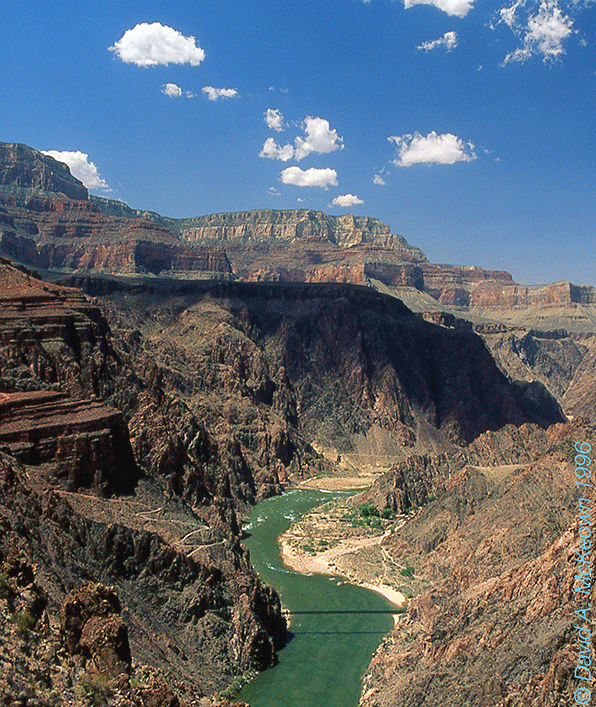
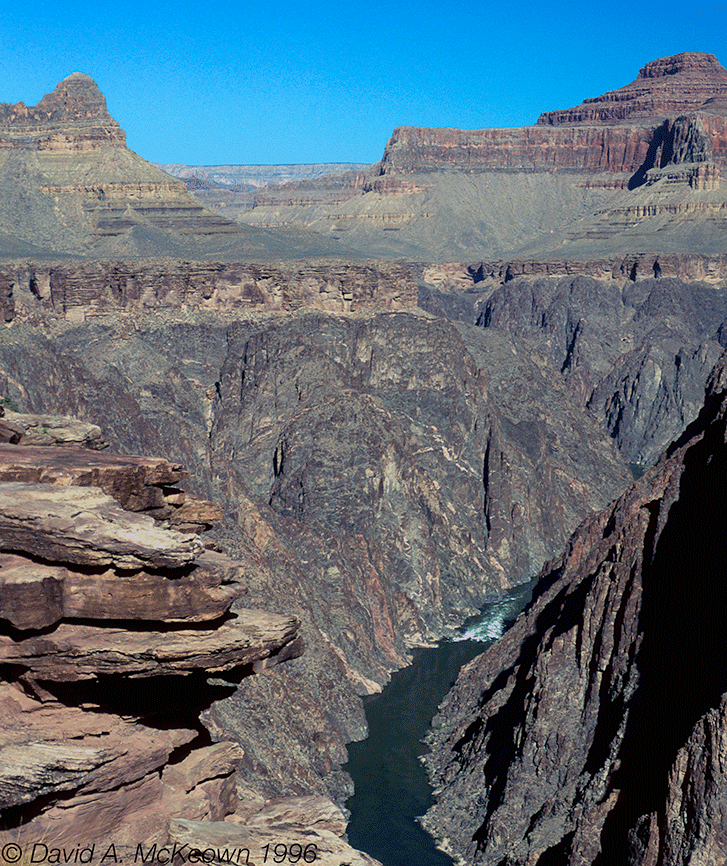
Entering the Inner Gorge for the first time was like going to another planet. The emerald waters of the now visible Colorado River stood out against the chocolate browns and blacks of the Inner Gorge cliffs.
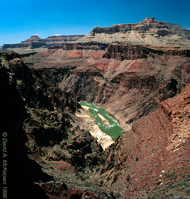
South Kaibab Trail 2-96: Entering the Inner Gorge.
A raft loaded with river-runners would occasionally float by on this calm stretch of the Colorado River. The trail continued to switch-back down the canyon walls, when two suspension bridges crossing the Colorado came into view. The black suspension bridge to the east was the one I would cross to reach Phantom Ranch and a break from the heat. The air temperature must have been over 100 degrees (F) by the time I reached river level, where white sand covered the area approaching the Ranch. It felt like I was in a double heat source oven: the sun above and the hot, white sand radiating heat from below.
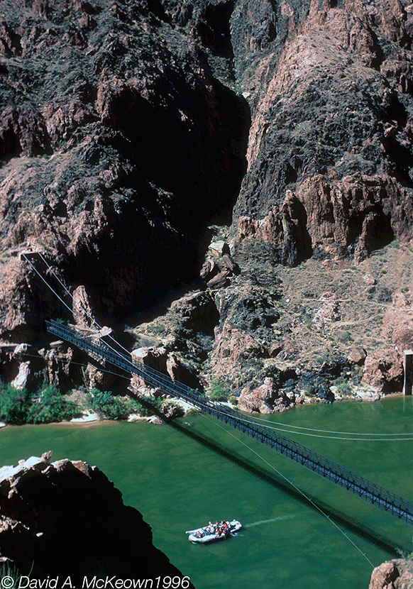
Colorado River 22-96: Approaching the black suspension bridge and Phantom Ranch.
Phantom Ranch is located on Bright Angel Creek by the Colorado RIver, and provides basic amenities for canyon travelers. It is home to park rangers and workers that keep the food, lodging, and transportation facilities functioning. Many of the buildings are air-conditioned; and on this hot day, the cool air and cold lemonade in the Ranch’s Canteen were welcome relief. For visitors that stay over night in the dormitory buildings, the lodging is economical but not luxurious. The Ranch is at the hub of a few major trails, where one can explore areas around the Inner Gorge that cannot be realistically reached in one day from either rim. On my agenda were the North Kaibab Trail, which follows Bright Angel Creek to the North Rim, and the Clear Creek Trail, which climbs up to the Tonto Plateau north of the Colorado and parallels the River to the east. The only time restriction was that to be fed, I needed to be back at the Ranch Canteen for 5:00 PM dinner. Breakfasts and dinners are promptly served family-style at specific times of the day.
The next day, my hike was north along Bright Angel Creek and to see if I could go the distance to reach Ribbon Falls, a sight worth seeing, according to the rangers. From the trail, the view back to the South Rim was impressive as most of the one mile thick rock column could be seen. The orange-brown rock walls surrounding Bright Angel Creek provided a different look compared with the sedimentary rock layers seen on the Tonto Plateau and above. Vegetation was sparse, but patches of prickly pear cacti provided some color by the trail, while agaves were clinging to the canyon walls above. It was warm by mid morning and became hotter as the day wore on. Traveling farther north, the inner gorge walls fell away and the distant North Rim cliffs could be seen. The falls were not reached that day, because time was running out to return in time for steak dinner that evening… Ribbon Falls was placed on my growing list of excuses to return another day.
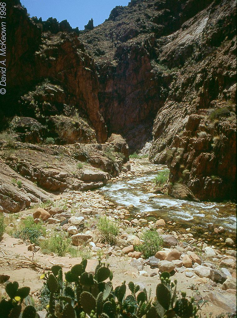
North Bright AngelTrail 23-96. Blooming prickly pear cacti near Bright Angel Creek.
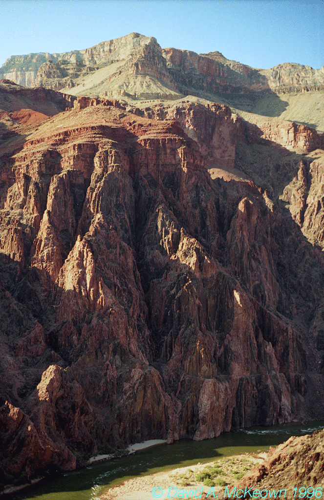
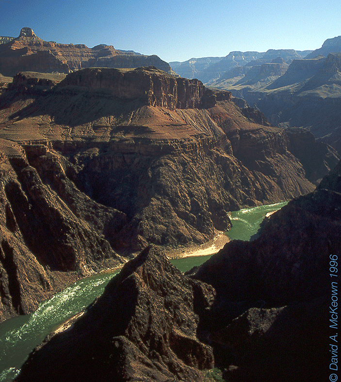
On the Clear Creek Trail the next morning, scenic views of the Inner Gorge and the Colorado River below could be seen along many stretches of the trail. The trail followed the “Great Unconformity” or the contact between the metamorphic and igneous rocks of the Inner Gorge and the sedimentary rocks above. This contact is an erosional surface that represents a 1.3 billion year gap in the rock record. The Grand Canyon can be described as an open book to the Earth’s past, but many of its pages are lost to erosion.
Clear Creek Trail 2-96:: View west with the black suspension bridge (foreground) and Phantom Ranch (by the green trees, lower right of center).
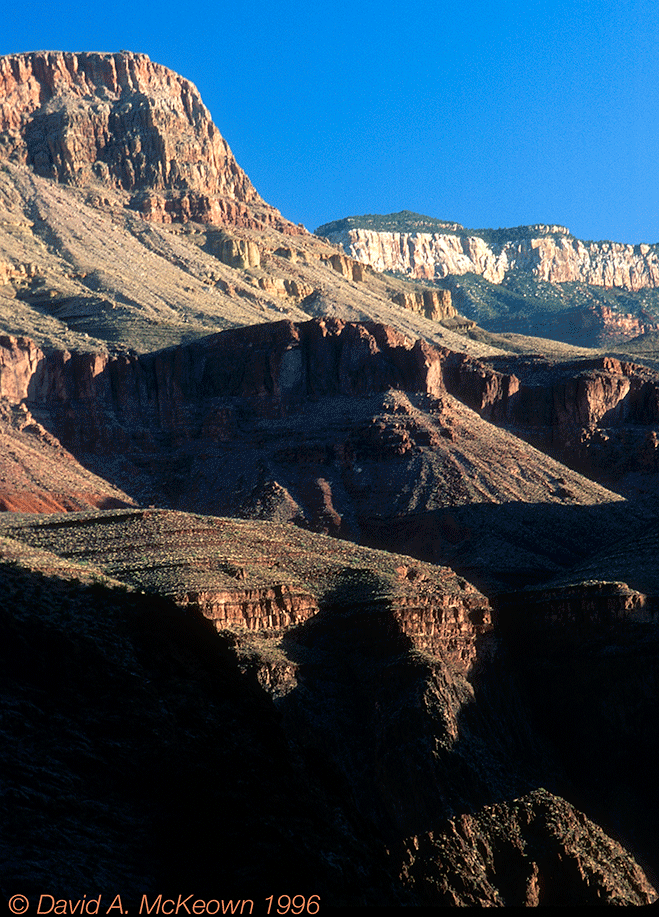
Once on the Tonto Plateau, the cacti, agaves, and yuccas provided occasional color and interest. Returning to the Ranch, my lunch was near the trail on a bench fashioned out of slabs from the metamorphic rock that made up the Inner Gorge. The darkly colored seat was hot from the sun, but the view was worth an extended stay by standing up for a while.
Clear Creek Agave 16-96: Looking southwest to the South Rim in the distance.
Clear Creek Trail 11-96: A view of the rock column and the Colorado River looking to the South Rim.
My last day in the Canyon featured the long climb out. The first stage climbed the 1800′ elevation change by following the Bright Angel Trail to Indian Garden. After a flat three mile side trip to Plateau Point, the second stage climbed the remaining 3500′ to Kolb Studio on the South Rim. The day started with the hiker’s breakfast at 5:00AM. I was on the trail by 5:30 in the cool air along the river: an excellent time to make tracks and leave behind the hottest parts of the canyon. After crossing the silver suspension bridge and following the river west, the serious climbing started when the trail entered Pipe Creek. In shadow most of my way up the Creek, colorful cliffs could be seen when the rising sun was starting to light the Canyon.
Bright Angel Trail 23-96: The early morning hike out through Pipe Creek.
I reached Indian Garden by 8:00 AM, where it was time for water and a rest before taking the hot (even by 9:00 AM) dusty trail to Plateau Point. Blooming agaves were scattered around the trail as I made my way to the point. The view at the point was worth the extra effort: some 1800′ below, the Colorado River and Crystal Rapid could be seen and heard.
Plateau Point 35-96: Looking west.
Plateau Point 32-96: Looking east and my last view of the Colorado River and Inner Gorge for that day.
The rest of the day was spent hiking up through the sedimentary layers, enjoying the views, and looking forward to my reward: dinner at the restaurant in the El Tovar Hotel on the South Rim. By 3:30 PM, I was standing by the Kolb Studio on the South Rim, after traveling the one vertical and 12 horizontal miles from Phantom Ranch, and looking back at what I explored the last three days.
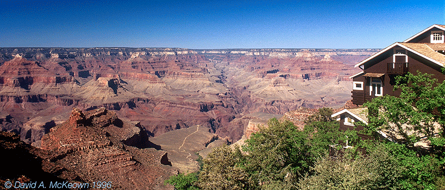
Kolb Studio 35-96: View from the South Bright Angel Trail head on the South Rim.
There’s nothing like that special soreness and stiffness that comes with hiking out of the Grand Canyon.